
*This environmental suitability, precipitation, and temperature monitoring maproom is now open to the general public; however if you need access to environmental suitability forecasts, please fill out the form on the Contact page and we will get back to you as soon as we can.
Maproom Details
The Aedes-borne diseases’ environmental suitability (AeDES) maproom allows decision makers to monitor and forecast diseases (including Zika, dengue, and chikungunya) transmitted by the Aedes albopictus and Aedes aegypti mosquitoes to better prepare their communities for future outbreaks. This tool incorporates four different environmental suitability models, considering climate factors and mosquito life cycle. Please see here for technical model details.
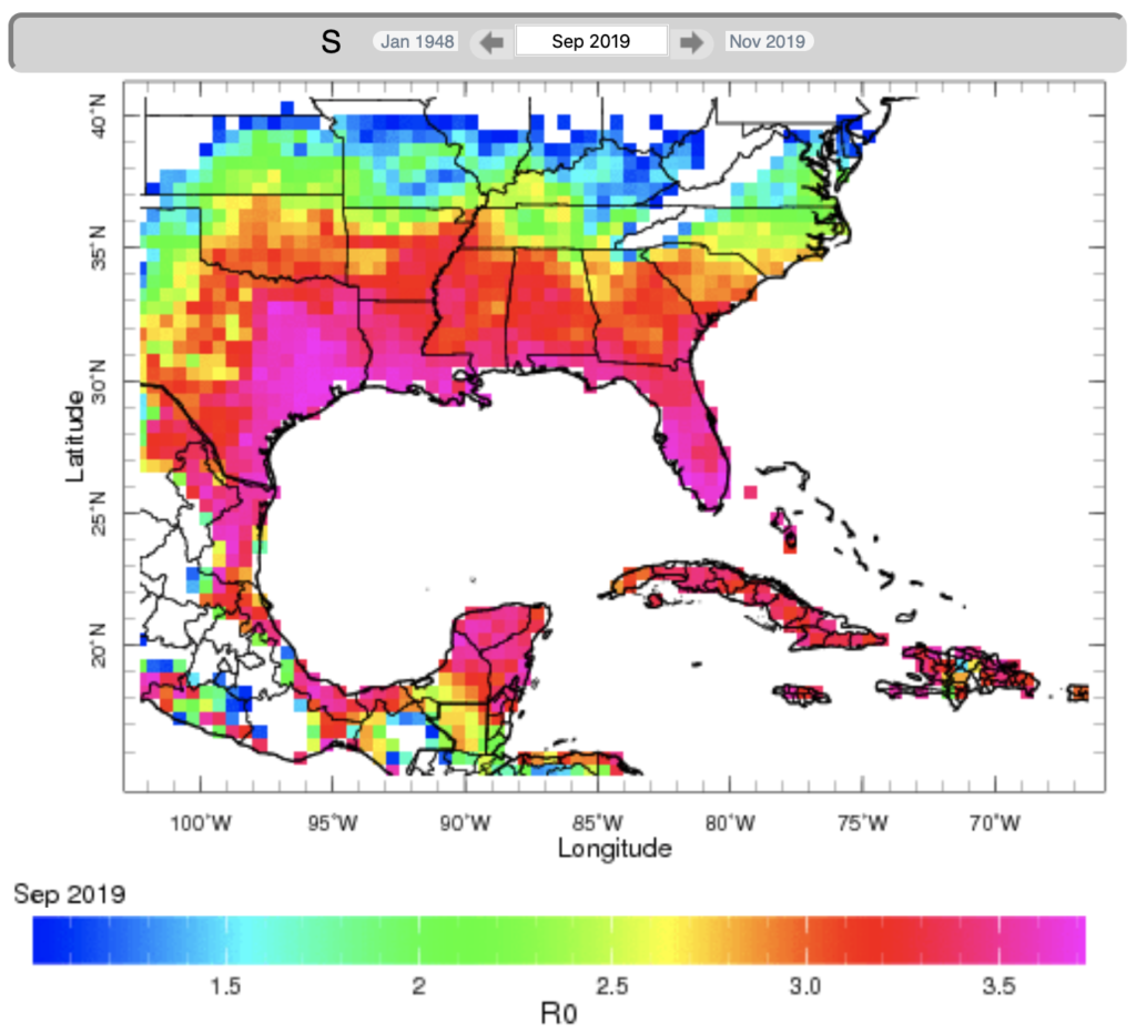
The maproom provides access to all monitored environmental suitability values in North America, Central America, the Caribbean, and northern South America since January 1948. With its highly interactive interface, you can select locations on the map and zoom into specific areas of interest. By selecting a point on the map, you can view region specific climate information that includes average monthly values for environmental suitability, precipitation, temperature (minimum, median, and maximum), and number of wet days.